|
| *****SWAAG_ID***** | 28 |
| Date Entered | 10/01/2011 |
| Updated on | 10/06/2011 |
| Recorded by | Stephen Eastmead (admin) |
| Category | Vernacular Record |
| Record Type | General HER |
| Site Access | Public Access Land |
| Record Date | 11/08/2008 |
| Location | Sleigill, Booze, Reeth just south of North Rake Hush |
| Civil Parish | Reeth |
| Brit. National Grid | NZ 01599 02918 |
| Altitude | 366m |
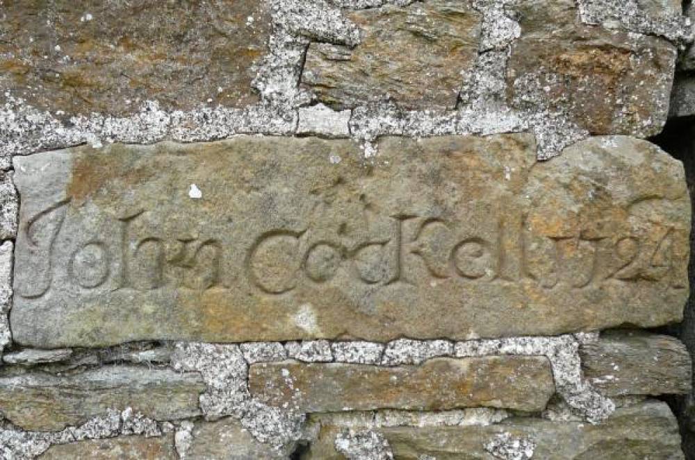
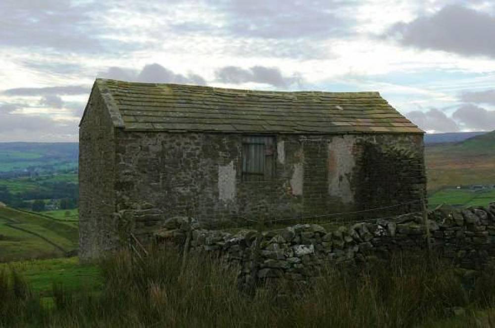
| Record Name | Miner-Farmers farmhouse - John Cockell 1724 |
| Record Description | 18th Century ?Miner/Farmer farmhouse with stone engraved with: John Cockell 1724. Engraved stone between doorway and blocked up window to the right of the door. Located on the West side of Slei Gill and to the south of North Rake Hush.
Engraved stone approx 50cm x 20cm Building in good condition. In agricultural use in 2008. |
| Additional Notes | Brian Gaunt quotes: "We know little of John Cockell, the house was known as Cockleshell home and is shown on old (1837) maps. My ancestors (Stones) were lead miners who lived here. The only reference I have found to a John Cockell in that year is as a steward (rent collector) in Wensleydale. That may be a link." |
| Image 1 ID | 36 Click image to enlarge |
| Image 1 Description | Front aspect facing south east | 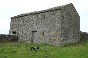 |
| Image 2 ID | 37 Click image to enlarge |
| Image 2 Description | Engraved stone beside the door |  |
| Image 3 ID | 38 Click image to enlarge |
| Image 3 Description | Rear of farmhouse |  |